Geospatial Image Analysis has never been easier thanks to the WOLF VPX6U-TESLA-P6-DUAL-HPC graphics board. Firstly, it uses advanced NVIDIA® Tesla® PascalTM 16nm GPU technology. This rugged Pascal-based board runs in NVIDIA’s HPC mode. Which exposes a very large 32GB memory base address register (BAR) for direct access to the GPU memory from the CPU and other PCIe devices.
The Tesla P6 includes support for NVIDIA GRIDTM, the industry’s most advanced technology for sharing true virtual GPU (GRID vGPU™) hardware acceleration between multiple users. This technology ensures complete application compatibility, which means the features and experience are the same as they would be on a physical device.
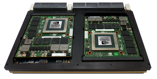
The rugged VPX6U-TESLA-P6-DUAL-HPC board includes air-cooled and conduction cooled options.
Features
- 32 GB GDDR5 memory with NVIDIA GPUDirect™ DMA technology
- Error Correcting Code (ECC) to protect against memory errors
- 12.4 TFLOPS
- Pascal GPGPU parallel processing:
- 4096 CUDA®cores
- CUDA Toolkit 9, CUDA Compute version 6.1
- OpenCL™ 1.2, DirectX® 12, OpenGL 4.5, Vulkan 1.0
- Memory width: 256-bit to each GPU
- Maximum memory bandwidth: 192 GB/s to each GPU
- PCIe x16 Gen3
- NVENC/NVDEC accelerator for HEVC (H.265) and AVC (H.264) hardware encode/decode
- Windows and Linux drivers
Specifications
- High level of ruggedisation:
- Rugged air-cooled or conduction-cooled
- Operating temperature: -40° to +65°C
- Vibration (sine wave): 10G peak, 5 – 2000Hz
- Shock: 20G Peak
- Front I/O and Rear I/O configurations
- Supported VPX configurations:
- VPX-REDI (ANSI/VITA 48.x)
- OpenVPX (ANSI/VITA 65)
Lastly, this Graphics Board is an excellent choice for Aerospace and Defence Applications. Firstly, the
impressive processing capabilities such as advanced parallel processing and TFLOPS of processing speed make it perfect for ISR (intelligence, surveillanceand reconnaissance), C4 ISR (command, control, communications, computers ISR), image processing, terrain analysis, object tracking or 3D visualisation of geospatial data and geospatial image analysis.
For more information on this product, contact us.